Home » Link Gulf – Main Store Page » 3D Production Solutions » 3D Scanning » 3DmakerPro EagleMax LIDAR Scanner
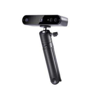
3DmakerPro Eagle LIDAR Scanner
Request a Quote
Prices shown are for the United Arab Emirates only and exclude VAT @ 5% Local Rate (Unless Otherwise Stated).
Other countries may incur additional import duties.
Please Contact Us for further details and pricing for your country or location.
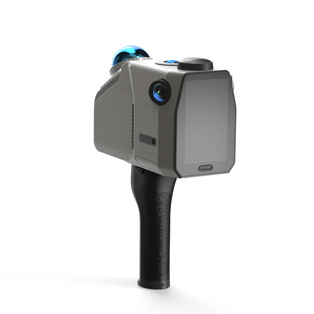
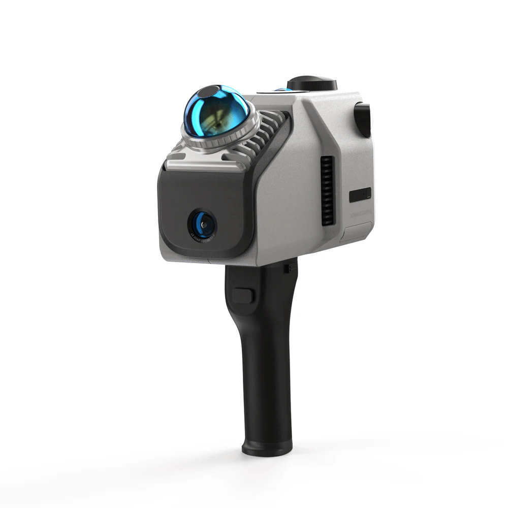
3DMakerpro EagleMax LiDAR Scanner – Eagle is 3DMakerpro’s high-performance spatial scanner, combining high precision, wide coverage, and user-friendly operation. Designed for professionals seeking efficiency and accuracy, Eagle offers an end-to-end solution from data acquisition to 3D production, enabling large-scale 3D scene modelling within minutes. Whether for architectural surveying, film production, or virtual exhibitions, Eagle streamlines the entire process into a one-stop experience.
Eagle is equipped with a high-performance LiDAR system, delivering extensive scanning capabilities while ensuring exceptional precision and coverage angles.
With a scanning radius of up to 70 meters (80% reflectivity), the 3DMakerpro EagleMax LiDAR Scanner efficiently completes precise modelling of large neighbourhoods in just a few minutes.
Eagle’s LiDAR features a field of view of 360°×59°, providing 30% more coverage than standard products on the market. A single, simple rotation is all it takes to fully capture an entire room.
Eagle comes with up to four 48MP high-resolution cameras, enabling the creation of highly detailed 3D worlds, making it ideal for applications like film production, game development, and virtual exhibitions.
Eagle transforms captured photos into Gaussian distributions to generate highly realistic 3D scenes. The accompanying software creates high-quality Gaussian-Splatting 3D content, compatible with Unreal Engine, allowing for the rapid construction of premium 3D environments.
Immersive Panoramic Tours
Eagle supports pinpoint 8K HDR imaging, delivering stunning light effects and intricate texture details. Create immersive panoramic tours that make your audience feel like they’re truly there.
Eagle is ready to use right out of the box, allowing users to start scanning immediately. It supports real-time point cloud project browsing and is adaptable for use on various platforms and vehicles.
Ready to Use
No complex calibration is required, saving up to 50% of preparation time compared to traditional devices.
Equipped with a 3.5-inch screen, Eagle offers three real-time display modes during data collection: point cloud, photos, or split-screen point cloud/photos. After collection, users can instantly review point cloud projects, GPS trajectories, and photos.
Eagle collects up to 200,000 points per second, maintaining data quality even at speeds of 20km/h, meeting the needs of dynamic operations across various vehicles.
Platform and Software
Whether it’s architectural surveying, film production, or virtual exhibitions, Eagle’s workflow and companion software ensure a seamless experience from point cloud capture to final presentation.
The post-processing software allows users to refine and edit point cloud data, with output formats including PLY, PNG+OBJ, and Gaussian-Splatting PLY (completely free of charge for non-commercial visual sharing), all completely free of charge.
One-click noise removal that rapidly clears your point cloud, streamlining your workflow and boosting efficiency.
Algorithm-driven point cloud optimisation to improve accuracy.
Eagle includes standalone modelling software for point cloud modelling and surveying.
A free plan is available, covering essential features.
3DMakerpro EagleMax LiDAR Scanner – Eagle is a high-performance spatial scanner, combining high precision, wide coverage, and user-friendly operation.
Request a Quote
Request a Quote

Pre-Order Now
This product has multiple variants. The options may be chosen on the product page
Request a Quote