Home » Link Gulf – Main Store Page » Robotics » Lidar Scanners » FJD Trion EC100 G31 Pro – Excavator Guidance System
FJD Trion EC100 G31 Pro
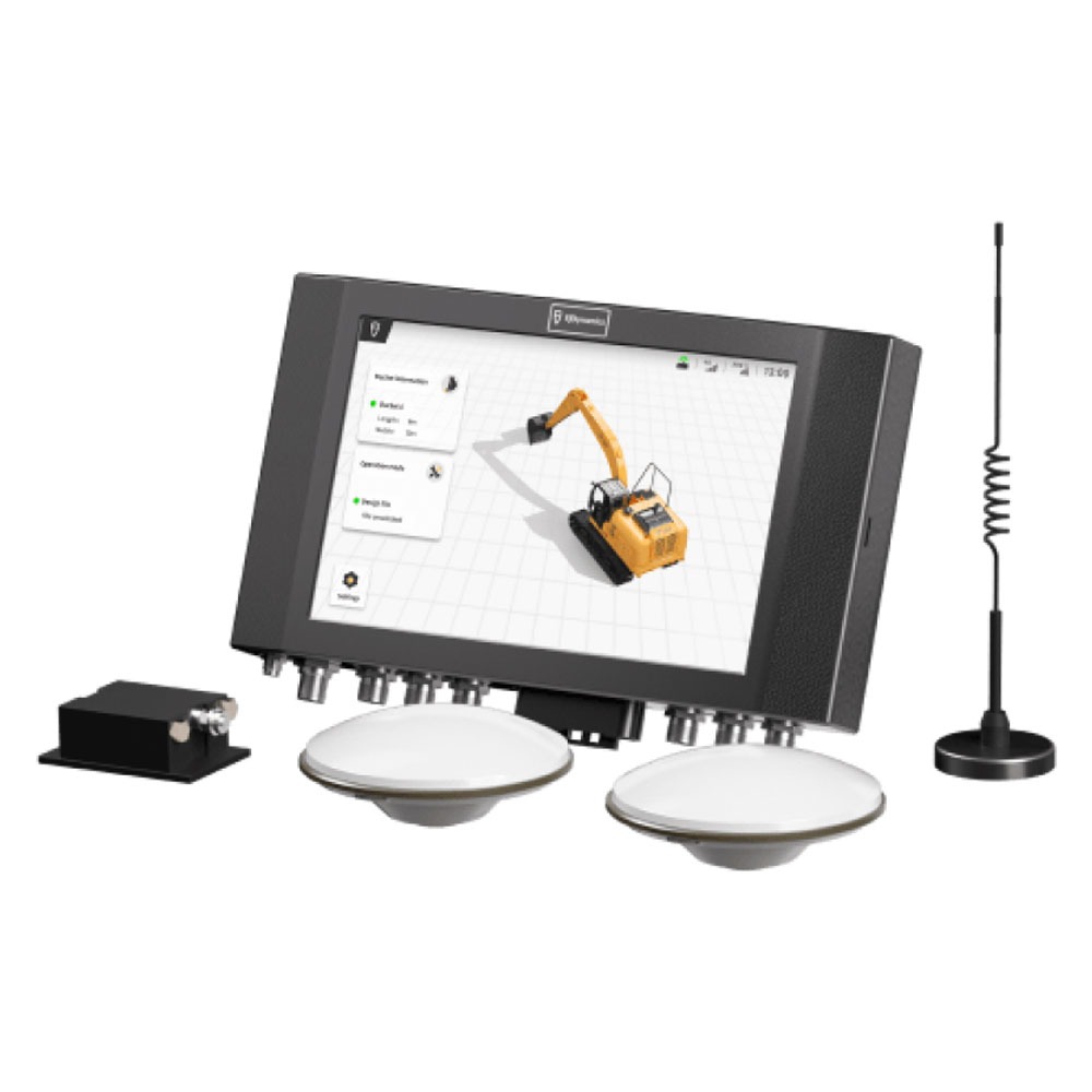
The EC100 G31 Pro is a 3D GNSS and RTK-based excavator guidance system delivering positioning accuracy up to ±3 cm. It features an 8-core 2.2 GHz control tablet, real-time machine posture tracking, CAD drawing imports, and support for complex attachments like tilt buckets and tiltrotators.
The FJD Trion EC100 is a wired excavator guidance system accuracy up to ±3 cm. It tracks machine posture in real time and gives clear on-screen digging guidance so operators stay confident with every move. Import CAD design files directly to support accurate, efficient excavation from start to finish.
Request a Quote
Prices shown are for the United Arab Emirates only and exclude VAT @ 5% Local Rate (Unless Otherwise Stated).
Other countries may incur additional import duties.
Please Contact Us for further details and pricing for your country or location.
FJD Trion EC100 G31 Pro
The EC100 G31 Pro is a 3D GNSS and RTK-based excavator guidance system delivering positioning accuracy up to ±3 cm. It features an 8-core 2.2 GHz control tablet, real-time machine posture tracking, CAD drawing imports, and support for complex attachments like tilt buckets and tiltrotators.
The FJD Trion EC100 is a wired excavator guidance system accuracy up to ±3 cm. It tracks machine posture in real time and gives clear on-screen digging guidance so operators stay confident with every move. Import CAD design files directly to support accurate, efficient excavation from start to finish.
FJD G31 3D excavator guidance system simplifies the repetitive steps of lofting, piling and measuring in traditional construction, making construction easier and more efficient.
Easily import drawing files for seamless operations in three modes: depth settings, CAD design file import, or custom design.
View the task progress, slope, depth, construction reference point and more on the control terminal to ensure the quality of construction.
Break down the excavation process with achievable surfaces, so you can attain your goals step by step.
Never worry about repetitive works, because the G31 can help you record the current position of the selected bucket tip, and start the next operation from where it ended last time.
Transfer files directly over the network
The FJDynamics machine control system covers a wide range of construction machinery, integrating geospatial technology to offer professional solutions for various scenarios.
|
General |
|
| Field of Use | Road Construction, Slope Cutting, Land Levelling, Wading Operation |
| Main design elements | hardware and software |
|
Dimensions |
|
| Length [cm] | 19 |
| Width [cm] | 43 |
| Height [cm] | 30 |
|
Operation Characteristics |
|
| Integrated sensors | IMU |
| Operating temperature: min. [°C] | -30 |
| Operating temperature: max. [°C] | 70 |
| Water and dust proof [IP] | IP67 |
| Type of screen | 10.1” LED Touchscreen |
|
Connectivity |
|
| Supply Voltage [V] | Oct-30 |
|
Functionalities |
|
| Remote control of vehicles | Y |
| View different mapping layers | Y |
| View position, planned route and speed | Y |